.png)

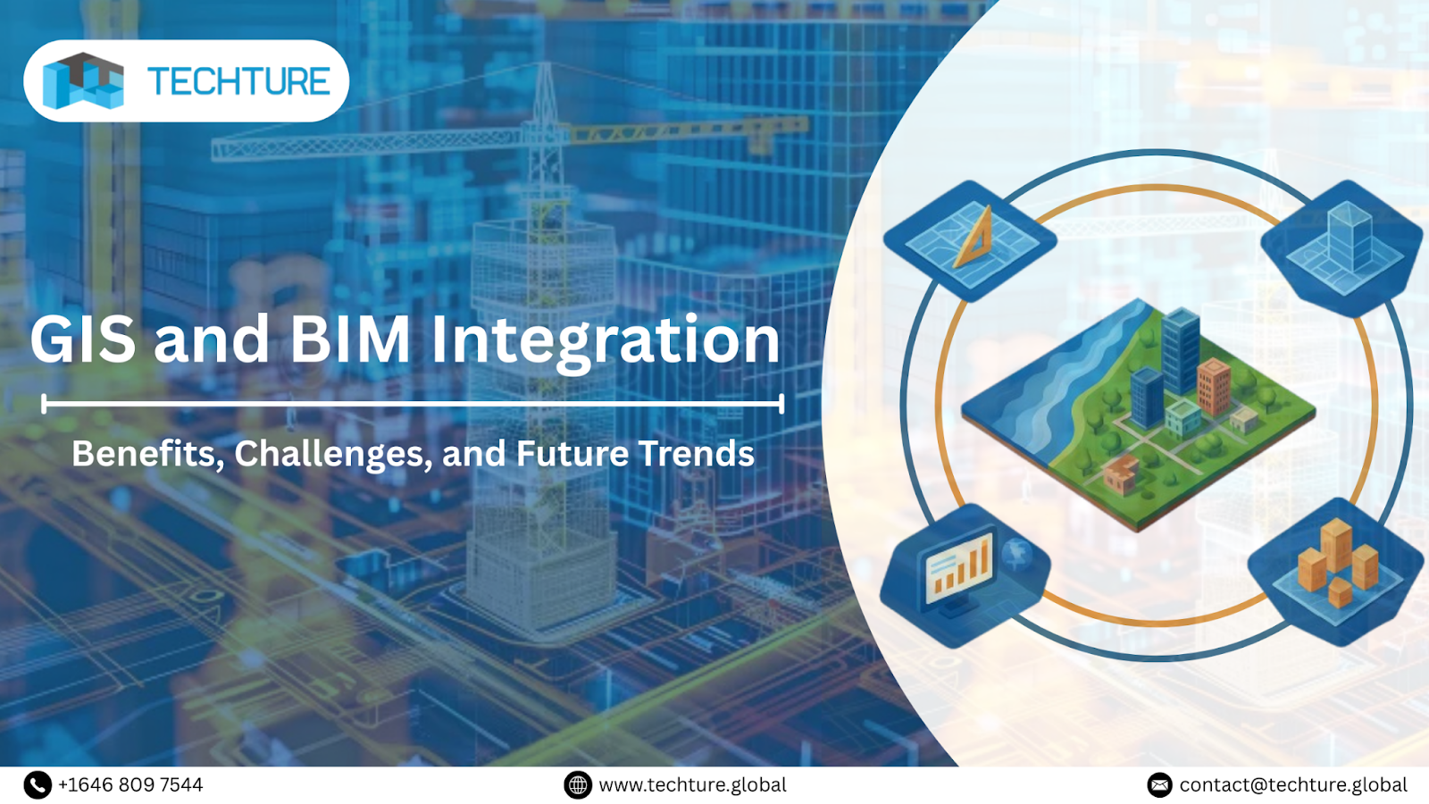
Introduction to GIS and BIM Integration
In the modern architecture, engineering, and construction (AEC) industry, construction and urban development are evolving rapidly with two technologies:
- GIS (Geographic Information Systems)
- BIM (Building Information Modeling)
While GIS focuses on the spatial and environmental aspects of infrastructure (the "macro" view of the real-world context), BIM provides a detailed 3D model of physical assets (the "micro" view of the building). When merged, this integration provides you with a data-rich system that reflects the project's geographical ecosystem through an intelligent 3D building model, improving decision-making for owners, contractors, and engineers and enhancing the project's operational efficiency.
In this article, we will help you understand these two technologies in detail and look at every aspect, right from the advantages, limitations, best practices, the future, and beyond.
What is GIS (Geographic Information System)?
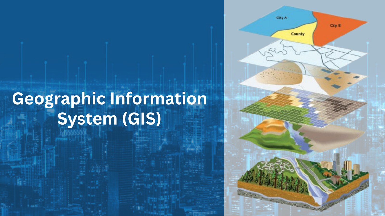
GIS (Geographic Information System) is a technology designed to capture, store, manage, analyze, and visualize geographic data for projects. It helps users to understand relationships, patterns, and trends across the locations.
GIS comprises several key components:
- Hardware: The mobiles, computers, and servers use to run software
- Software: Esri's ArcGIS or the open-source QGIS enables data visualization and spatial analysis
- People: The GIS analysts who design and run the system
- Data: The "geospatial" data (including terrain, land use, climate, and demographic information).
The GIS is widely used in urban planning, environmental management, transportation, and disaster risk assessment.
What is BIM (Building Information Modeling)?
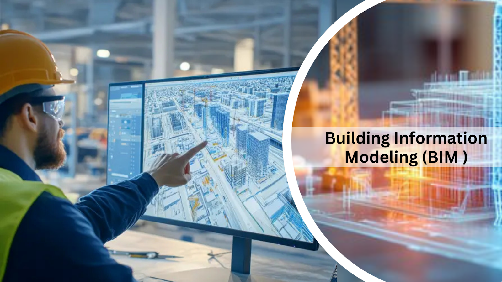
BIM stands for Building Information Modeling; it is a 3D model created through a collaborative, data-rich process that allows all project stakeholders, such as architects, engineers, contractors, and owners, to work on a common digital representation of an infrastructure asset. Despite their static nature, they serve as the basis for project accuracy and efficiency. This rich data model supports the entire lifecycle of a project, right from design and construction to operation.
Benefits of BIM include:
- A single shared digital platform.
- Enhance design visualization
- Reduced costly rework
- Improve collaboration and coordination.
- Supports clash detection, scheduling, cost estimation, and documentation.
Why Integrating GIS and BIM is Crucial for Modern Projects
Traditionally, GIS and BIM operated in separate, siloed worlds. GIS is used for regional planning, and BIM for 3D modeling (building-level design). However, the new projects demand a comprehensive approach that incorporates both technologies for better use of the site for their projects.
Integrating the GIS and BIM helps architects, engineers, and urban planners improve efficiency, reduce errors, and enhance collaboration by:
- Linking building data with geographic context: Helping you make precise decisions for better site use.
- Streamline workflows: to schedule construction according to the climate conditions.
- Support sustainability: Reduce the chance of geological damage due to poor planning.
- Improve asset management: By real-time geospatial awareness.
Benefits of GIS and BIM Integration in Construction
In this section, we will understand the benefits of GIS & BIM in the construction industry.
- Enhanced data visualization: Allows immersive visualization of structures interacting with real-world environments.
- Improved decision-making: By combining spatial & building information, it helps you make data-driven decisions on site selection, design optimization, and more
- Cost and Time Savings: The collaborative approach reduces rework, prevents design clashes, and enhances construction sequencing.
- Real-time collaboration: A common data environment (CDE) provides stakeholders with real-time updated versions of 3D models.
- Optimized resource management: Planners can use GIS to map the routes for material delivery for the detailed 4D construction schedule from the BIM.
Key Challenges in GIS and BIM Integration
Despite many benefits and positives, the integration of GIS & BIM faces some major challenges. Let's discuss each change one by one in this section
- Data interoperability: This is one of the biggest challenges because BIM & GIS use different data formats (e.g., IFC, Revit, and SHP), which makes data exchange complex.
- Software compatibility: Limited software standards and few unified platforms to integrate Autodesk Revit and Esri ArcGIS.
- Training: We have many skilled professionals for GIS & BIM separately, but to use these two collaboratively, the industry faces a gap in handling both effectively.
- High Implementation Costs: Due to the lack of software and professionals, it is difficult for an organization to implement it; it often requires a high investment to get things in place.
Technologies Enabling GIS and BIM Integration
- Cloud computing: Helps you share real-time data with a collaborative approach.
- Geospatial data services: Images from the satellite, LiDAR, and drone mapping help you enhance BIM models with precise topographical ecosystems.
- Software platforms: Advanced tools like Esri ArcGIS GeoBIM, Autodesk InfraWorks, and Bentley Systems’ iTwin connect building data with the geographic insights.
- APIs and Data Standards: Standards such as Industry Foundation Classes (IFC) and CityGML support interoperability.
Real-World Applications of GIS and BIM Integration
- Urban planning: Finland's Virtual Helsinki digital twin was developed with the integration of GIS & BIM. The project integrates these technologies with the zoning information to support sustainable city planning by simulating population growth and energy efficiency.
- Transportation: One of the biggest infrastructure projects, the Crossrail Project in London (UK), has used the integration of GIS & BIM for planning, coordination, and execution of tunnels, stations, and rail lines.
- Construction management: One of the best examples is the Sydney Metro project, which uses integration to monitor the real-time construction progress.
- Environmental management: For ecological conservation, the Netherlands Delta Program uses GIS and BIM integration for flood risk management.
The Future of GIS and BIM Integration in Smart Cities
In the fast-changing AEC industry, the GIS and BIM integration in smart cities will play a vital role in connecting building data with the geographical system. The future of both these technologies is said to be the digital twin. The digital twin is a real-time digital replica of assets. Integrating BIM and GIS data will enhance maintenance and management of the project. Additionally, smart decision-making will be enabled by connecting live sensor data with spatial and building models. Therefore, the future points toward a fully connected digital ecosystem where we will use both technologies for intelligent, adaptive, and sustainable urban growth.
Best Practices for Implementing GIS and BIM Integration
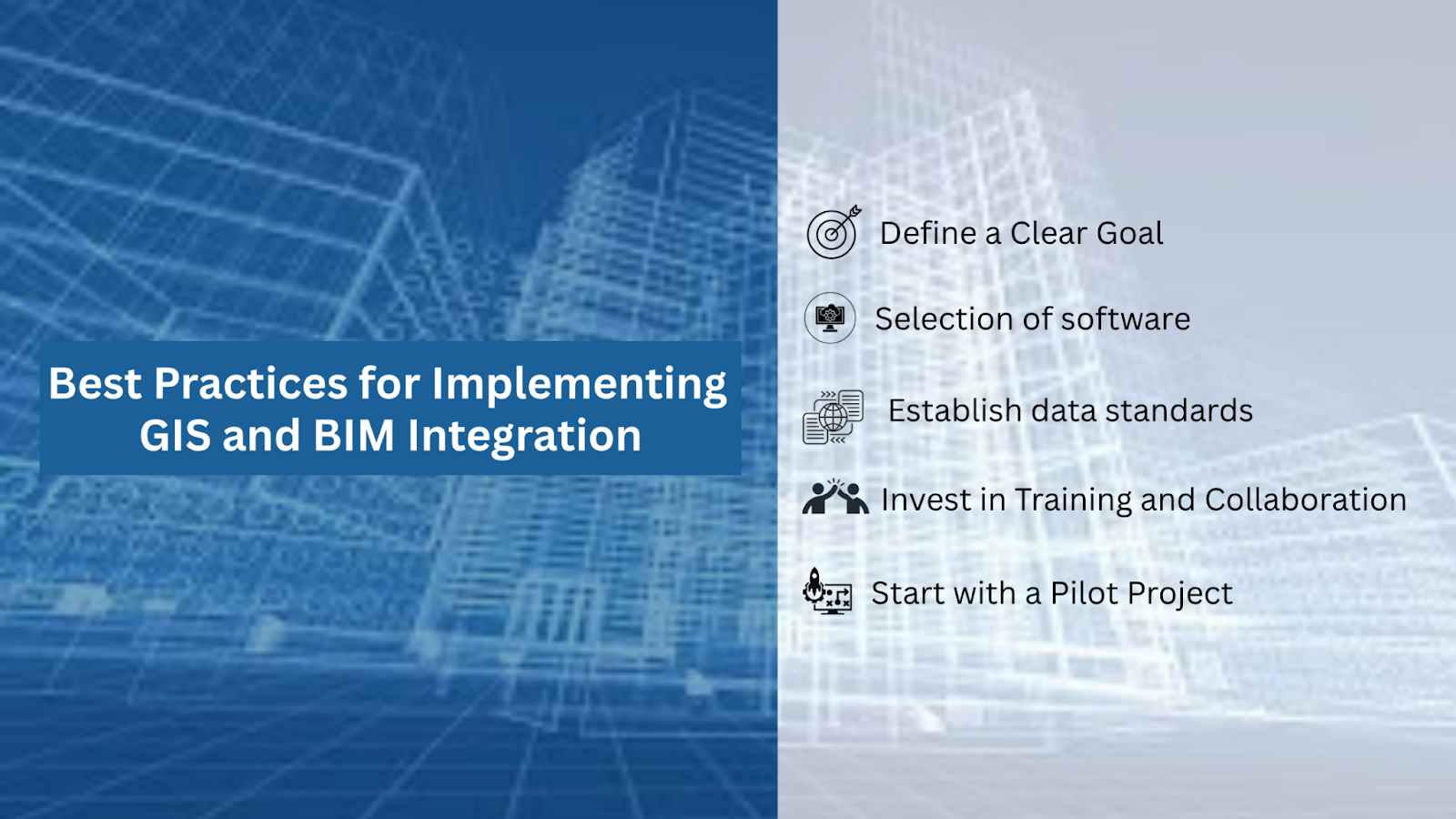
To ensure the best implementation of the GIS & BIM integration, follow the points below and excel in your projects
- Define a Clear Goal: Don't implement this integration just for the sake of the trend
- Selection of software: It is important to select the right software, such as Revit + ArcGIS GeoBIM, that are compatible with GIS & BIM.
- Establish data standards: consistent file formats, naming conventions, and metadata structures will help you understand, track, and access data effectively.
- Invest in Training and Collaboration: As it is very new in the industry, you need to step up a learning atmosphere in your organisation to train your professionals for the upcoming trends and technologies.
- Start with a Pilot Project: don't start implementing on a large project; start practicing on the small project, and once you excel in the small, start expanding your horizons.
Conclusion: The Synergy Between GIS and BIM
GIS and BIM are two of the most powerful technologies in a new era in the AEC industry. Bridging the gap between the macro-scale environment and the micro-scale asset, linking spatial intelligence with building information, professionals can make more data-driven decisions to create infrastructure according to its environmental constraints.
These technologies will evolve in the near future, but their integration will become a necessity in the upcoming urban planning and construction. In this article, we cover all the essential points to help you understand GIS and BIM, their importance, challenges, and benefits, and provide you with some best practices to incorporate these two technologies in your upcoming projects.
FAQs:
1. Can GIS and BIM integration reduce costs in construction projects?
Yes, it helps you minimize reworks and errors and improve coordination, resulting in reduced costs in construction projects.
2. What technologies are used to integrate GIS and BIM?
- Autodesk InfraWorks
- Esri ArcGIS GeoBIM
- Bentley iTwin
3. What steps should organizations take to start integrating GIS and BIM?
- Define a Clear Goal
- Selection of software
- Establish consistent data standards
- Invest in Training and Collaboration
- Start with a Pilot Project, not a big one.
4. How does GIS and BIM integration support sustainable building practices?
The integration helps you with better resource allocation, energy efficiency, and impact assessment.
5. How does GIS and BIM integration support better decision-making in urban development?
By visualizing new developments that can be fit within the existing projects and environment.


.jpg)